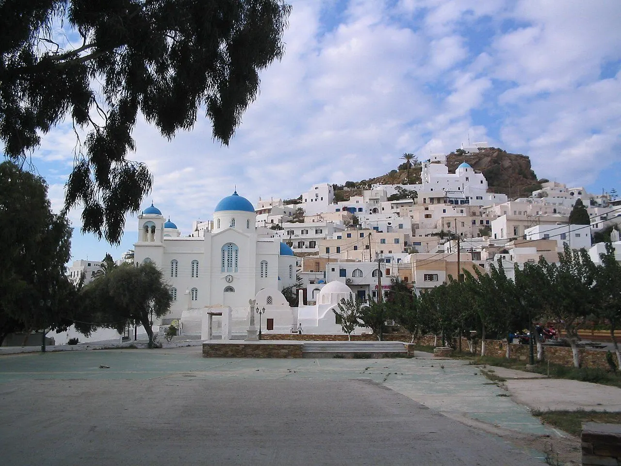
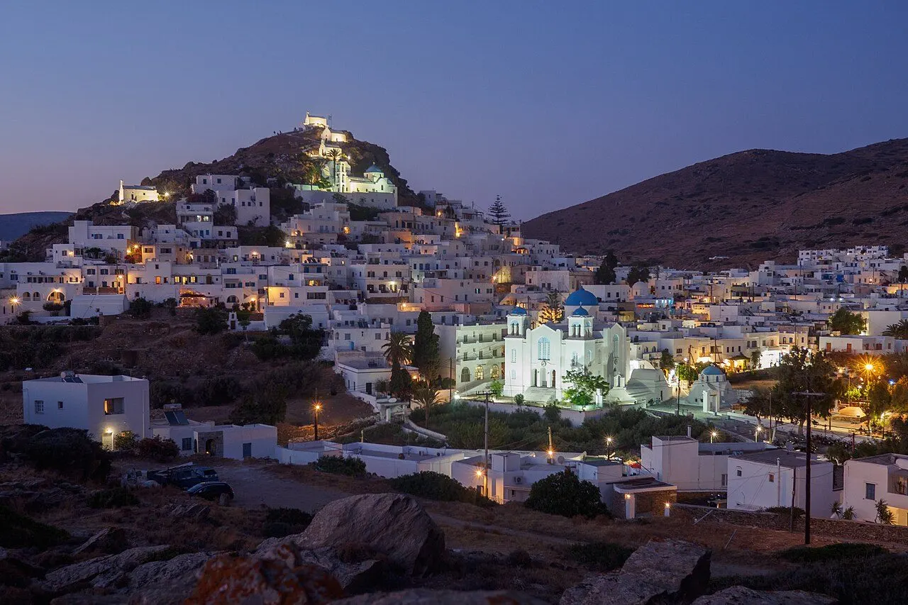
Chora of Ios on its hill, with the cathedral

Ios · Towns & villages

Towns & villages of Ios

Harbour towns, mountain hamlets and the places where island life still follows its own rhythm.

View of Chora, Chora & the port, Ios
01
Chora & the port

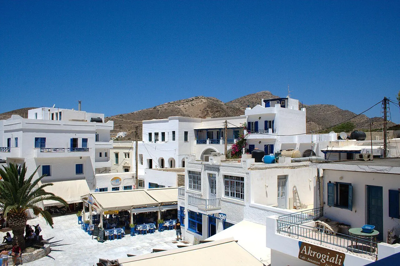
Chora

A white hill town by day and the liveliest night out in the Cyclades, with a Kastro, a row of windmills and dozens of bars in a few lanes

Chora, the island's only real village, climbs a steep hill above the bay of the port, about 2 km inland. By day it is a classic Cycladic town: whitewashed lanes paved with marble, blue-domed churches, the cathedral on its square, a row of windmills on the ridge and, at the very top, the church of Panagia Gremniotissa on the rock of the old Kastro. After about eleven at night the lanes around the main square turn into the party quarter of Ios, one of the densest knots of bars in Greece, where Slammer, Disco 69, Sweet Irish Dream and a dozen others play until dawn. Cars stay outside, at the foot of the hill.

  • The bar lanes around the main square after midnight
  • Sunset from Ios Club on the western hill
  • The windmills and the Odysseas Elytis Theatre
  • The climb to Panagia Gremniotissa at the top of the Kastro
  • The Archaeological Museum in the old town hall
Discover Chora
View of Mylopotas, Mylopotas & the south, Ios
02
Mylopotas & the south

Mylopotas

A long sandy bay 3 km below Chora, with the island's beach bars, campsites and FarOut Beach Club at its southern corner

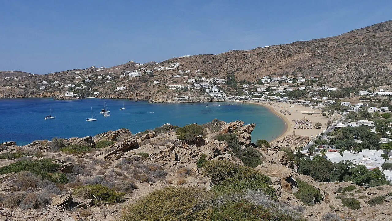
Mylopotas is the beach of Ios: a long, gently curving bay of fine sand on the south-west coast, 3 km below Chora, with clear, shallow water and a low hillside of hotels, rooms and campsites behind it. The name comes from the watermills, mylos, that once stood on the stream that runs down to it. It is the island's most organised beach, with straw umbrellas, beach bars, water sports and tavernas, and in summer it is where the day of a party week on Ios takes place. At its southern corner FarOut Beach Club runs pool parties and DJ nights; at the northern end, nearer Chora, it is quieter.

  • FarOut Beach Club at the southern corner
  • Fine sand and shallow turquoise water
  • Water sports and beach bars
  • The bus to Chora through the night
  • The view from the Odysseas Elytis Theatre above the bay
Discover Mylopotas
View of Gialos & Koumbara, Chora & the port, Ios
03
Chora & the port

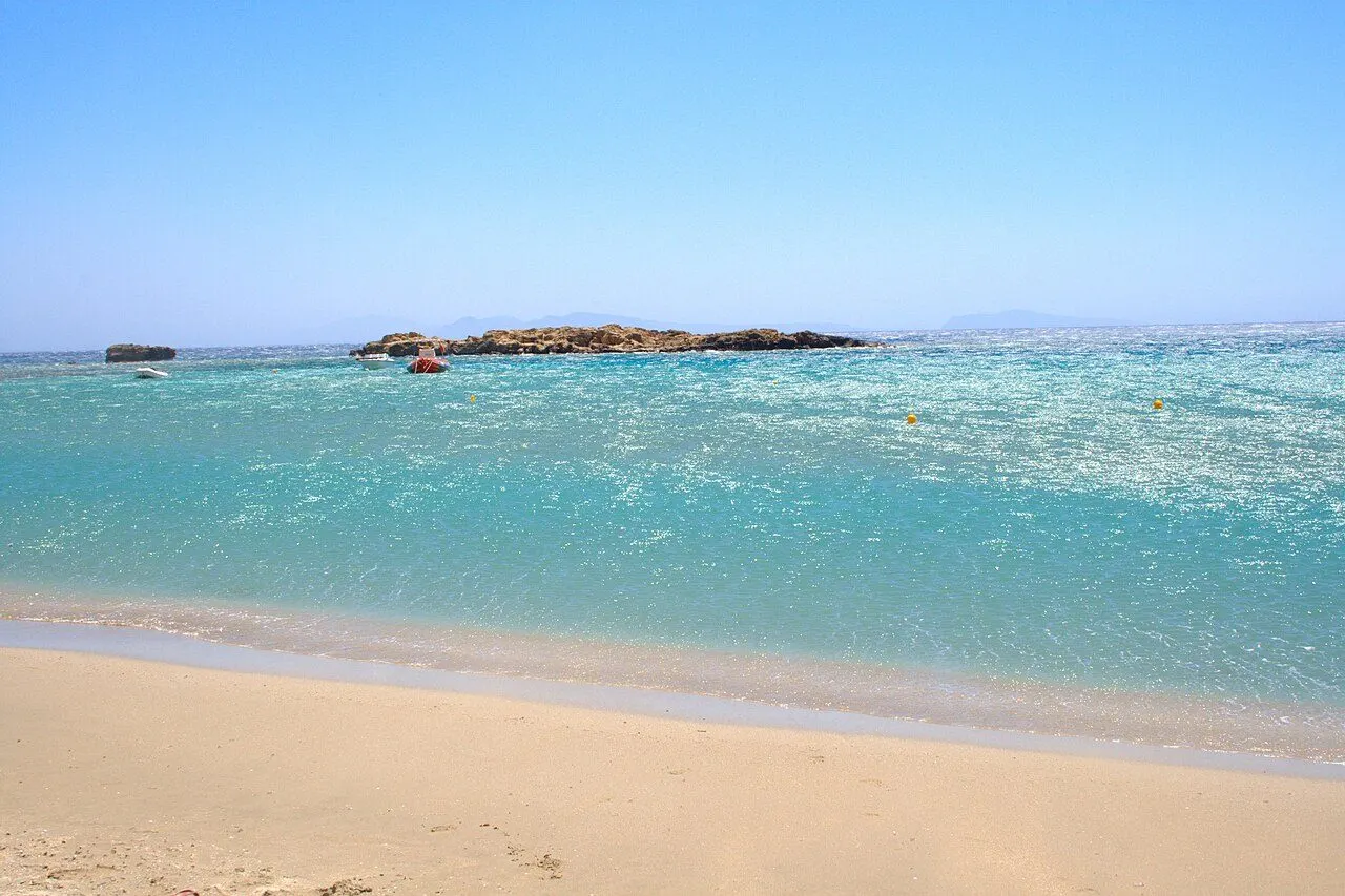
Gialos & Koumbara

The port in its deep bay, a long sandy beach under the tamarisks and a quiet cove at the end of the road

Gialos, also called Ormos, is the port of Ios, in a deep, sheltered bay on the west coast below Chora. The ferries dock at its quay; around the harbour are tavernas, cafés and travel agencies, and behind it runs a long sandy beach lined with tamarisks. At the harbour mouth stand the church of Agia Irini, with its two bell towers, and the lighthouse of 1881. A road runs on west for about 1.5 km to Koumbara, a small cove with a rocky islet and a calmer feel than anywhere else near town.

  • Fish by the boats in the harbour
  • The beach of Gialos under the tamarisks
  • The 17th-century church of Agia Irini
  • Sunset at Koumbara
  • The bust of Homer on the waterfront
Discover Gialos & Koumbara
View of Skarkos, Chora & the port, Ios
04
Chora & the port

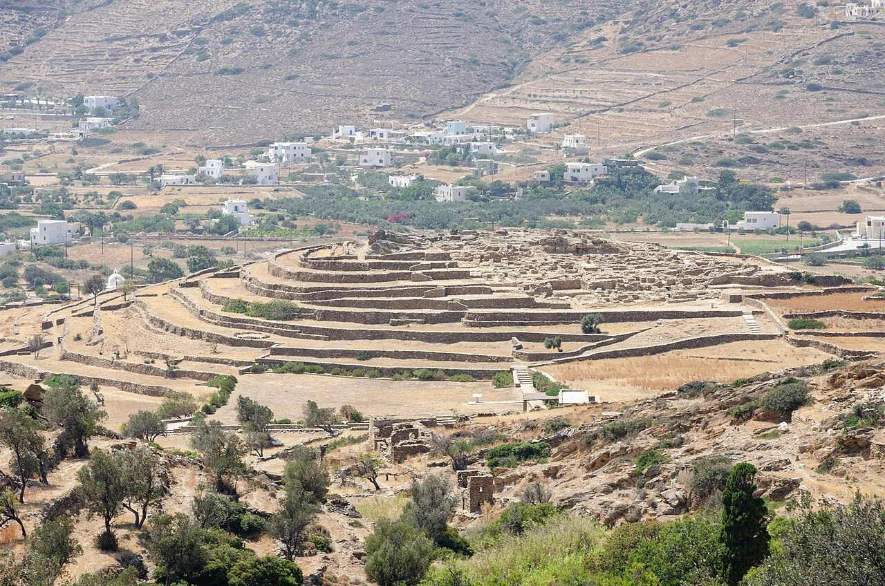
Skarkos

A town of about 2800 BC on a terraced hill between the port and Chora, with houses still standing two storeys high

On a low hill in the valley between the port and Chora lies Skarkos, one of the best-preserved Early Cycladic settlements in the Aegean. It was a town of about 2800 BC, with streets, drains and two-storey houses whose stone walls still stand up to nearly 3 m. It has been excavated, restored and opened to visitors, with paths and signs, and in 2008 it won the European Union prize for cultural heritage, the Europa Nostra award.

  • Two-storey houses of about 2800 BC
  • Walls nearly 3 m high
  • The view down over the bay of Gialos
  • The finds in the Archaeological Museum in Chora
Discover Skarkos
View of Manganari, Mylopotas & the south, Ios
05
Mylopotas & the south

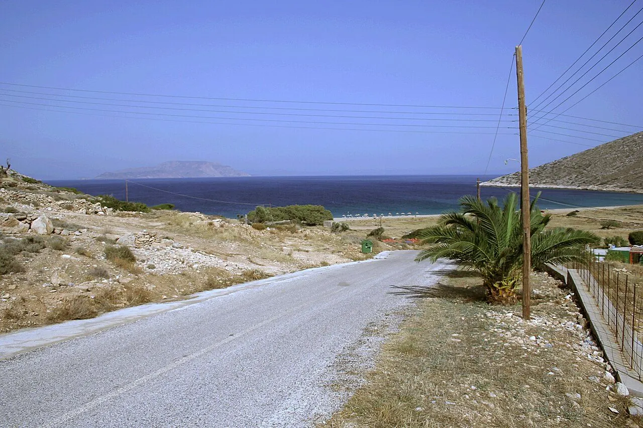
Manganari

A chain of white sandy coves at the bottom of the island, sheltered from the north wind

Manganari is a string of sandy coves at the southern tip of Ios, facing south and so sheltered from the meltemi, with white sand and very clear water. A long road crosses the empty hills of the south to reach it, and in summer a boat runs from the port. One cove is organised, with sunbeds and tavernas; the others are quieter. There is no village, only a few rooms and tavernas.

  • White sand and very clear water
  • Shelter from the north wind
  • Fish lunch on the beach
  • The drive across the empty south
Discover Manganari
View of Agia Theodoti & Paleokastro, The east coast, Ios
06
The east coast

Agia Theodoti & Paleokastro

A wide sandy bay on the far side of the island, a 16th-century church and the ruins of a Venetian castle on the ridge above

On the north-east coast, about 12 km from the port across the hills, the road ends at the bay of Agia Theodoti: a wide sandy beach with clear water and Naxos and Paros on the horizon. Above it stands the 16th-century church of Agia Theodoti, built, it is said, over a temple of Apollo. On the ridge to the south, a cobbled path climbs to Paleokastro, the ruins of a medieval castle built by the Venetians, with the white church of the Panagia Palaiokastritissa inside its walls and a view over Naxos, Paros and Amorgos.

  • The sandy bay of Agia Theodoti
  • The 16th-century church above the beach
  • The walk up to Paleokastro
  • The feast of 7–8 September
Discover Agia Theodoti & Paleokastro
View of Plakotos & Homer's tomb, The north, Ios
07
The north

Plakotos & Homer's tomb

The hill at the northern tip where, the ancient writers said, Homer died

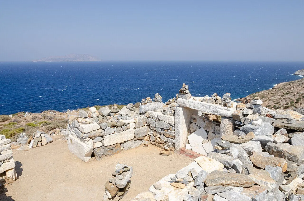
At the northern tip of Ios, on the hill of Psathopyrgos above the bay of Plakotos, a stone doorway and a few walls among the rocks are known as the tomb of Homer. Herodotus, Pausanias and Strabo all tell the story that the poet died on Ios, and the islanders minted coins with his head in the 3rd and 2nd centuries BC. Below the hill are the remains of an ancient aqueduct and a Hellenistic tower. The view runs over an empty, wind-scoured coast to the open sea.

  • The so-called tomb of Homer
  • The view over the north coast
  • The Hellenistic tower and old aqueduct
  • The bay of Plakotos
Discover Plakotos & Homer's tomb

Regions

Where to base yourself in Ios

01

Chora & the port

The hill town and its bar lanes, the windmills and the Kastro, the harbour of Gialos with its beach and Koumbara, and the Bronze Age town of Skarkos on the hill between them.

02

Mylopotas & the south

The long sandy bay below Chora, the island's party beach with FarOut at its corner, and the white coves of Manganari and Tris Klissies at the southern tip.

03

The east coast

The empty side of the island: the bay and church of Agia Theodoti, the Venetian castle of Paleokastro, and the remote beaches of Psathi and Kalamos.

04

The north

Wild hills and the bay of Plakotos, below the hill where Homer is said to be buried.

Find a place to stay

Browse hotels and guesthouses across Ios, filtered by region and price.

Browse hotels

Last updated